February 1, 2014 was one of the first warm days of the year, which was especially nice after the recent descent of the Polar Vortex. So, with a high of 63 degrees, and a desire for adventure I decided to walk the 11 miles from Hermitage to East Nashville along the Music City Greenway in the lovely “summery” weather. Please note that all photos are from my iPhone 5.
The walk began at the “Welcome to Donelson” sign on Lebanon Rd just after the old steel truss bridge that was the original gateway on the Donelson-Hermitage line. After crossing the bridge, the greenway heads uphill and continues along the bluffs next to the Stones River. Its quite scenic at all times of the year and during the spring and summer months, with everything in bloom, you forgot that you’re in the suburbs. One of the best parts of these fall/winter saunters are that without the foliage obscuring the woodland views, its quite easy to see the hidden gems along the path: such as old bridge abutments, an airfield, stonewalls, and more! During the warmer months, I like to take my bicycle ‘Icarus’ and ride the greenway to Nashville as it is definitely my preferred method for going downtown.

View of the steel truss bridge from the greenway
One of my favorite parts of this walk, especially when riding Icarus, is the hills at the beginning. Once you climb them, they give you a great boost of speed during the descent, allowing me to reach speeds of nearly 30 mph! However, on this day, since I was walking, it was still nice as the light afforded me many spectacular scenes, especially as I approached the still active farmland, surrounded on half its perimeter by the greenway. Its funny in a way, with the propensity of Scottish heritage in this region, that the rich hues of yellows, browns, and orange, afforded by the dried/dead species of grass would replicate many a scene of the Scottish countryside. After the farmland, you come to a bend in the river, with a tree providing a smidgen of shade, as well as a bluff that provides quite a view of the mouth of the Stones River emptying into the mighty Cumberland River. This is my favorite part of the greenway, and a great spot for a picnic.
Walking the farmland perimeter

Walking along the Stones River bluffs.


Once you pass the farmland and the low lying soccer fields, climb the big hill up to McGavock Pike, walk behind McGavock High School, you reach Two Rivers Park. On this day, as on many a sunny day, the skate park next to the Wave Pool was filled with aspiring skaters, BMXers, and skateboarders; although, my picture doesn’t show it!
After Two Rivers is the descent towards the bridge crossing the Cumberland River, where, during the warmer months, its quite common to see the General Jackson Showboat heading towards Nashville, its topside decks filled with tourists in revelry. This is generally the halfway point in the hike as once you cross the bridge, you have 5 more miles until you reach the Shelby Street bridge, the official eastern gateway into the city. Once you cross the bridge and walk the spiral-descending path, you reach the Shelby Bottoms greenway path which parallels the Cumberland River into Nashville.
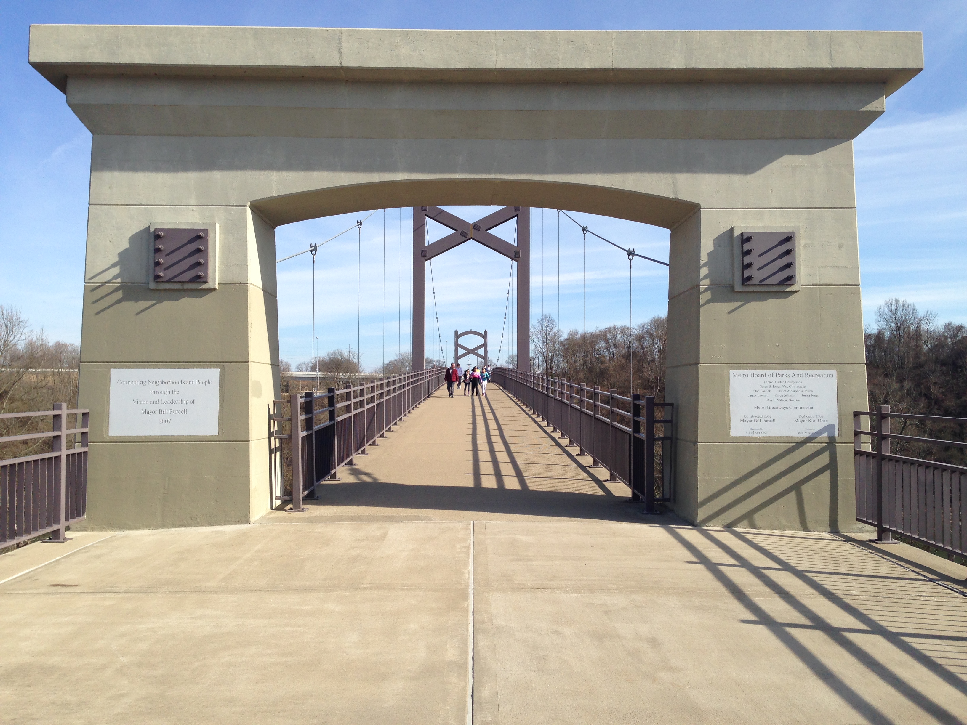
Western side of the Cumberland pedestrian bridge.
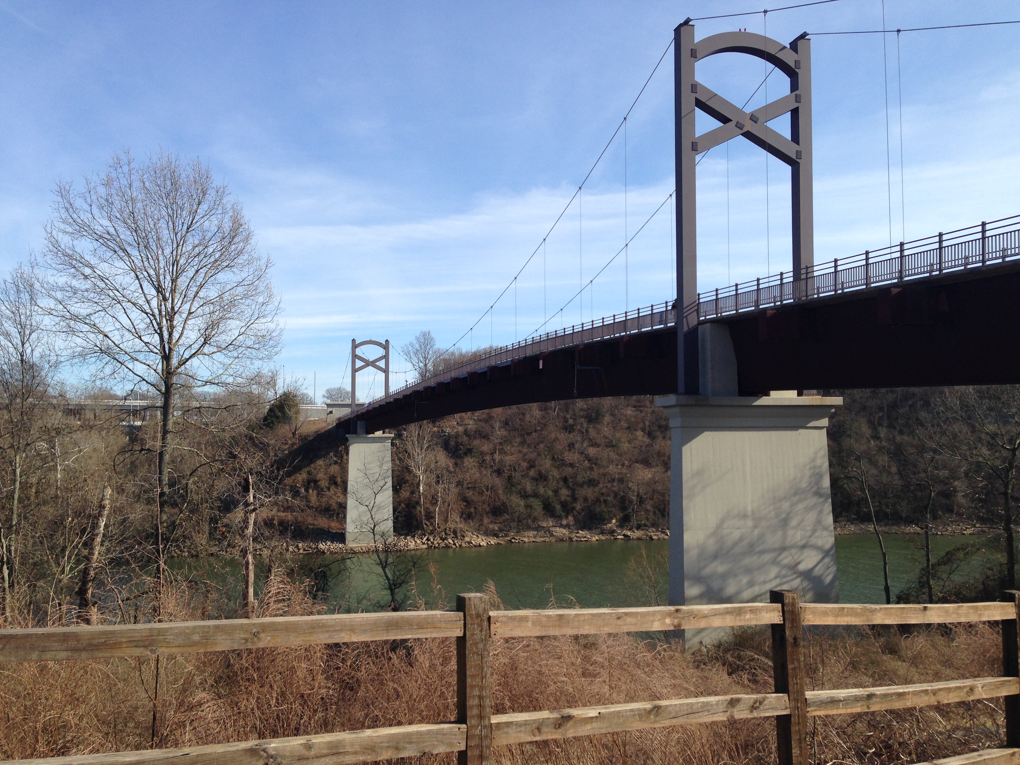
The Cumberland pedestrian bridge. As an engineer, I enjoy inspecting the cabling and trying to deduce the loading profiles of each member.
The Shelby Bottoms greenway tends to be a corridor of foliage, more so in the summer than winter, so I didn’t take a photo of the pathway as it really isn’t particularly interesting. From the bridge its around 3.5 miles before you reach the Shelby Bottoms Nature Center and a spectacular railroad bridge! On the other side of the river is the famed Omohundro water treatment plant. Its notable for two reasons: 1) it was Nashville’s first treatment facility and (2) it was the ONLY treatment facility that wasn’t compromised during the 2010 flood! An interesting story really: local prison inmates were used to pile sandbags as the waters rose and word is, had the waters of the Cumberland rose one more inch, we’d have lost all three of our treatment facilities and the entire Davidson-Metropolitan region would’ve been under a “boil water” advisory for months. But I bet most of the non-local people reading this blog never would’ve known that, as the national media did a complete disservice to our city and barely covered the flooding “story.” Most of us haven’t forgotten this. Alright, off the soapbox now.

Shelby Bottoms Nature Center with the spectacular railroad bridge in the background.
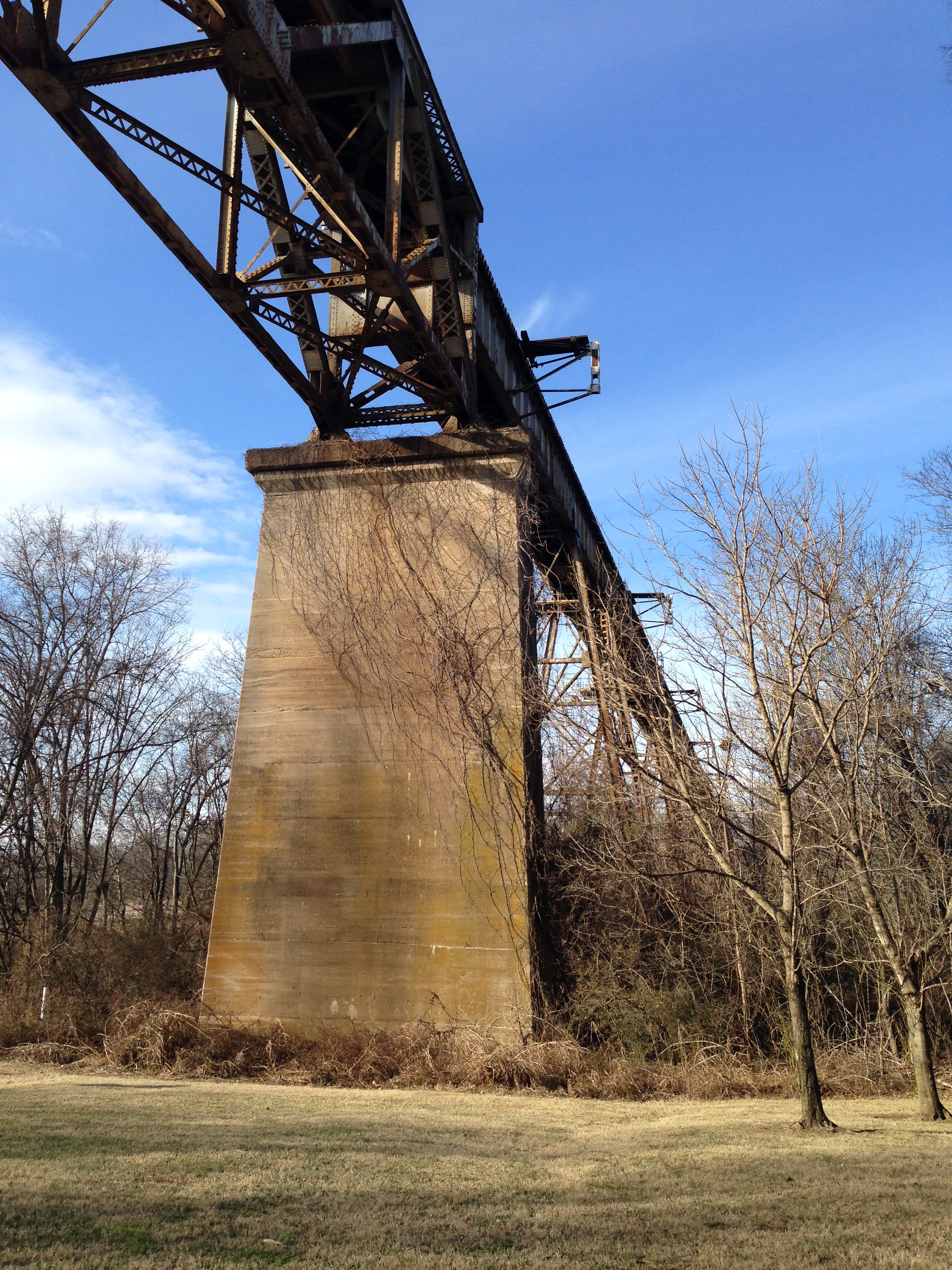
The spectacular railway bridge which crosses the Cumberland River and Shelby Bottoms area.
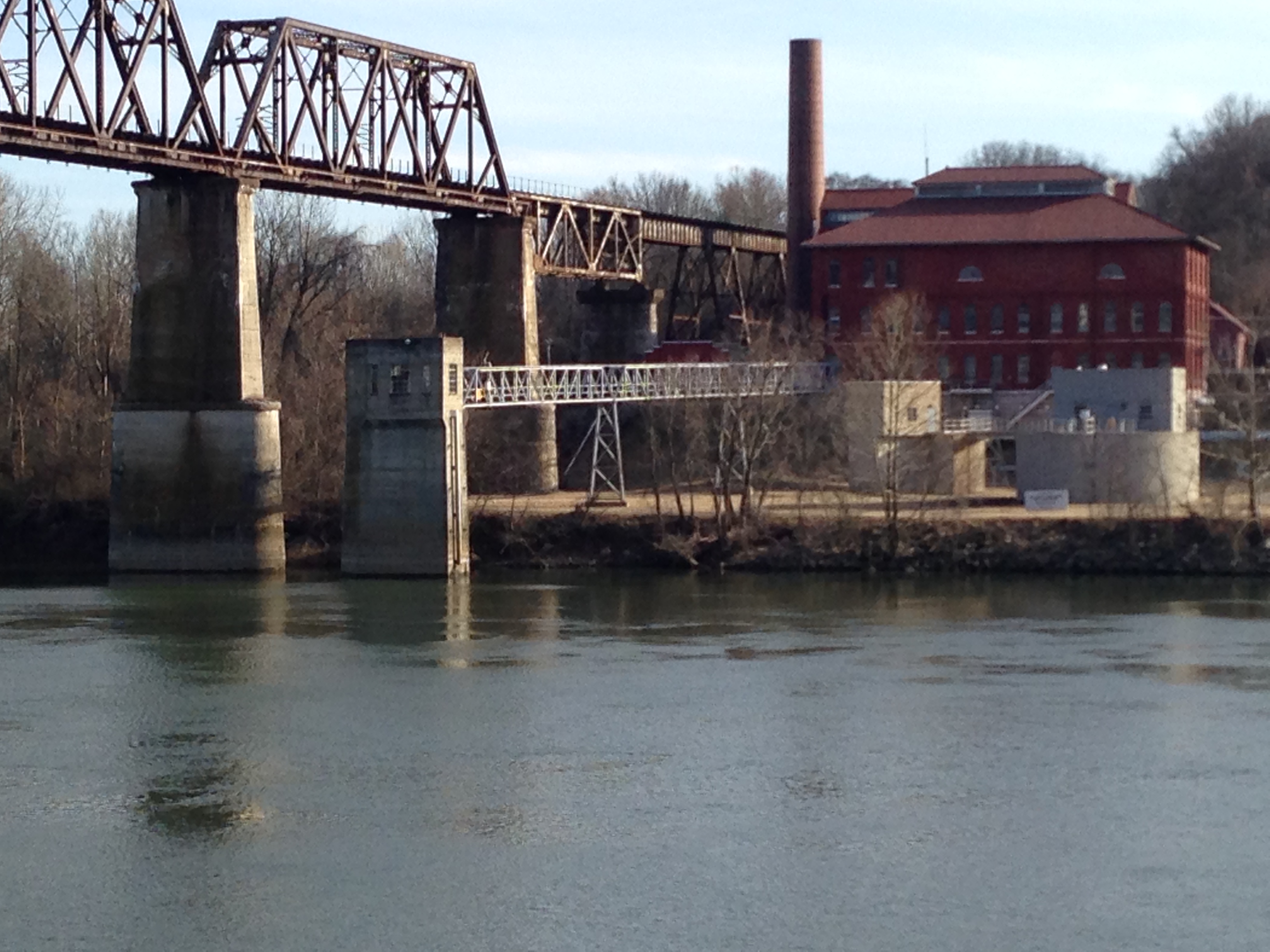
The railway bridge and the mighty Omohundro treatment facility. I love the brickwork!

Checkout the length of the bridge!
Once you cross underneath the railway bridge, you entire the Shelby Bottoms park with its many baseball diamonds, golf course, and lake! On this day since it was just after the descent of the Polar Vortex, the lake was still frozen, which the park conveniently mentions is “unsafe ice,” which, during all times but the winter, is a bit odd. Its a “Nashville thing” I guess. Anyways, be wary of unsafe ice in all your activities!
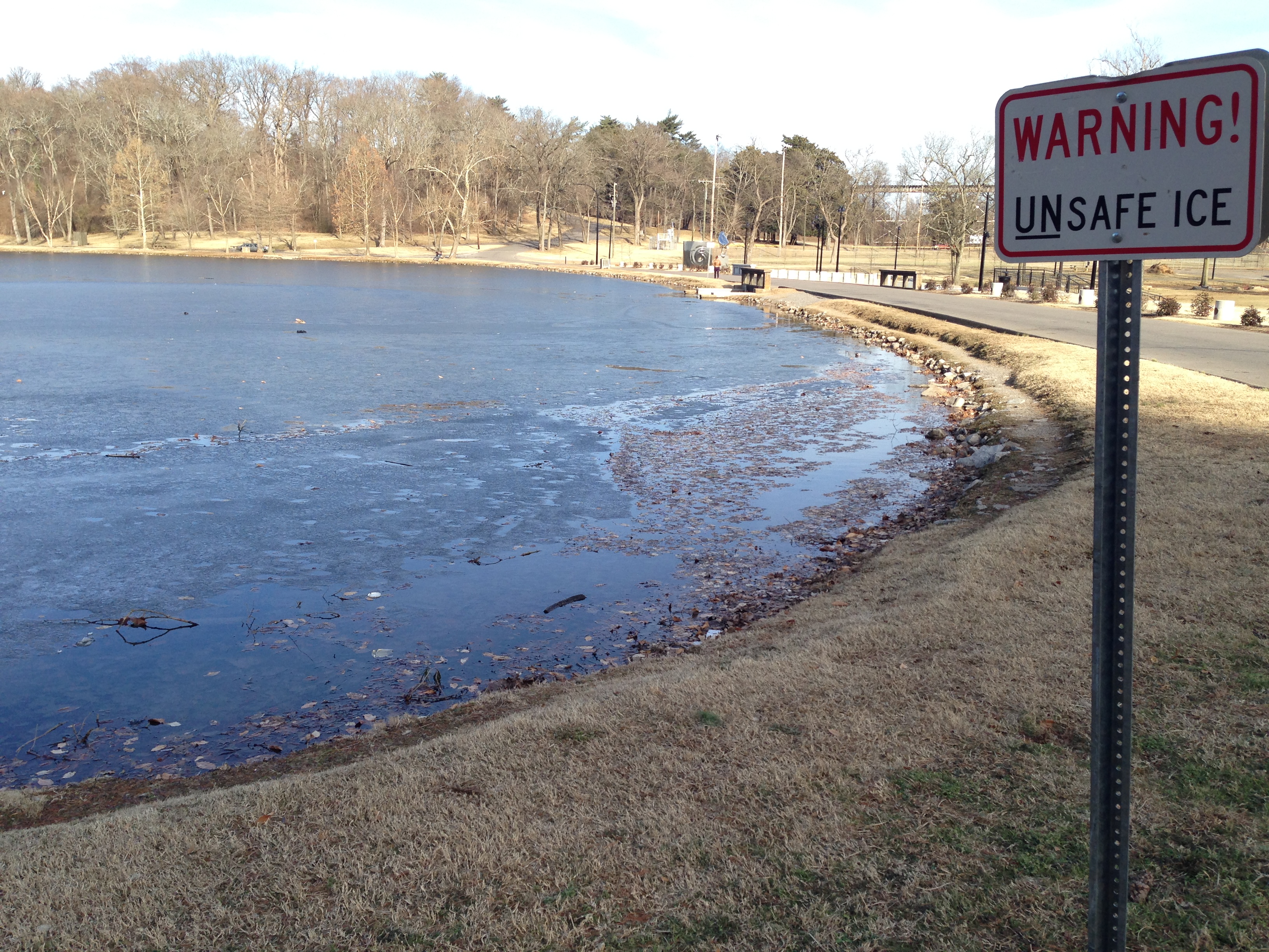
Better watch out for that unsafe ice!!!
After narrowly avoiding the unsafe ice, I continued on my walk to East Nashville as my favorite wine store, Woodland Wine Merchant was having a tasting of some great Beaujolais and Bourgogne wine. After the tasting, and seeing my acquaintances there, I caught a ride back to Hermitage to prepare for an art crawl later that night.
Nature walks such as these are my inspiration as well as my “reset button.” Things just make sense during long walks among forests, deserts, or mountains. I highly encourage everyone to take some time for themselves and saunter about through the nearest forest, desert, or mountainous region. You’ll emerge a different person than when you started, I can promise you that!
